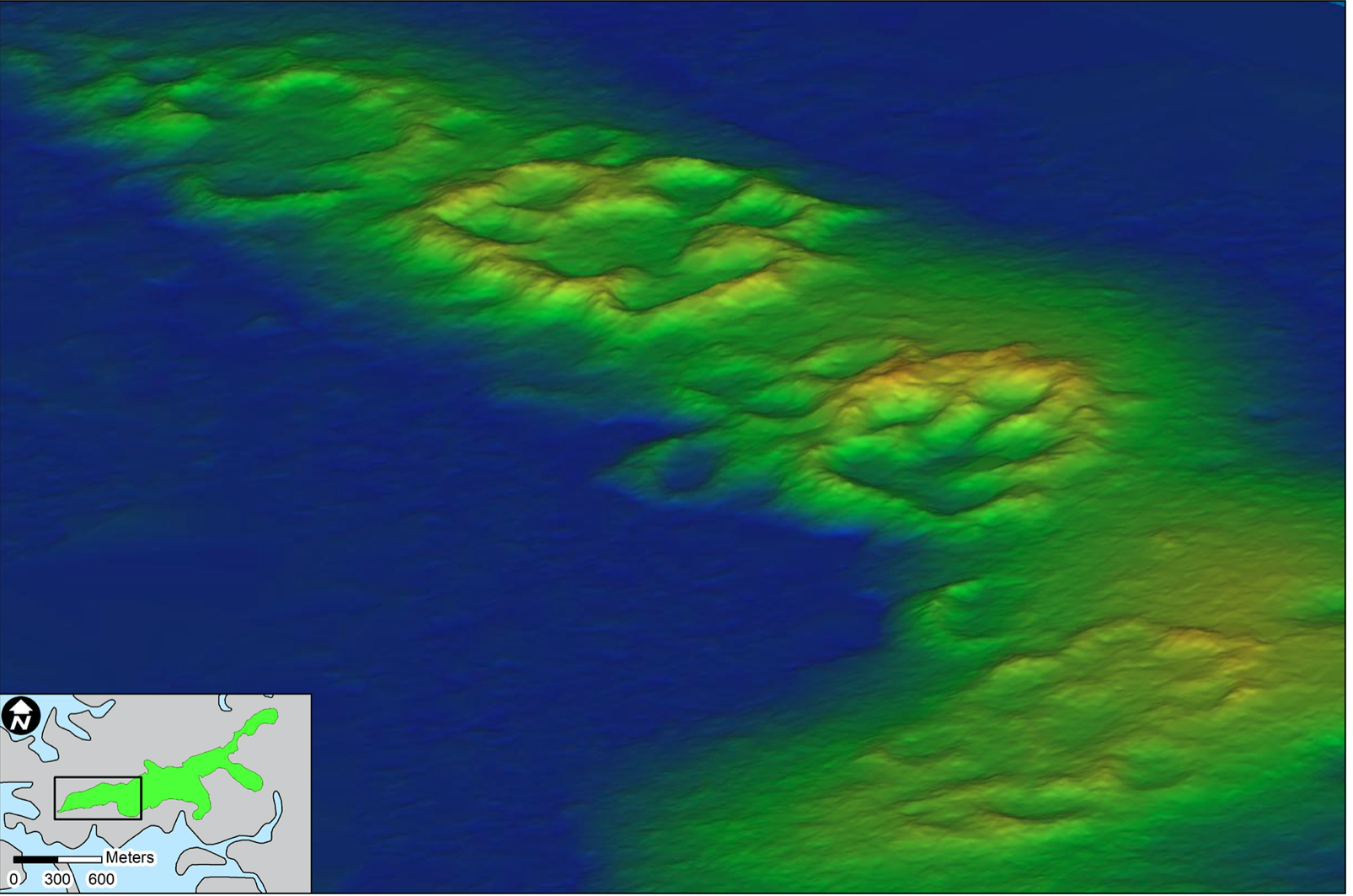
Lidar uncovers rings of oyster shells

University of Florida archaeologists, doctoral candidate Terry E Barbour and Professor Ken Sassaman, used aerial drones with light detection and ranging (Lidar) sensors – to create detailed 3D maps of the surface of Raleigh Island, off the coast of FL.
Although archaeological objects were first spotted on the island in about 1990, and subsequent exploration of the area in 2010 revealed the presence of a settlement dating from 900 to 1200 CE, Lidar scanning revealed previously unknown architectural details.

